Rates & availability change: Sumba Helicopter Tours is an independent travel and concierge service that connects you to vetted drivers and partners — we are not a government body. All prices are RANGES (IDR/USD) flagged with the date last verified and separate the base service from fuel, parking, and extras; confirm current rates, vehicle, and availability before booking. Bali charges an international tourist levy of IDR 150,000 per person. If you proceed with a partner we introduce, they may pay us a referral fee at no extra cost to you.
Sumba from above means seeing the island’s waterfalls, savannah, lagoons and villages from a helicopter, with a bird’s‑eye view you simply cannot get on the road. Experiencing Sumba from above reveals how wild, wide and sculpted the island really is: ridgelines folding into canyons, rivers feeding jade lagoons, and megalithic villages perched on headlands.
As an independent private-helicopter tour and transfer service, Sumba Helicopter Tours connects travellers to vetted local operators across the island. We do not operate aircraft ourselves, and we are not an aviation authority or a resort: our role is to help you decide what to see, understand realistic pricing, and then match you with a suitable operator if you plan your trip with us by email or WhatsApp.
Below you’ll find the Sumba landscape highlights that truly come alive from the air, how to combine them into half‑day and full‑day itineraries, honest price expectation ranges (last verified June 2026), and answers to the questions travellers ask most before chartering a helicopter here.
—
Why See Aerial Sumba by Helicopter?
From the ground, Sumba can feel fragmentary: a waterfall here, a village there, long drives in between. From the air, all those fragments connect.
- Scale and context: Helicopter flights reveal how the savannah hills, river canyons, and coastal cliffs relate to each other. You see watersheds, fault lines and coral shelves in one glance.
- Access to remote sites: Some waterfalls and inland ridges would normally require hours of rough driving and hiking. By helicopter, they become part of a single, coherent circuit.
- Time efficiency: A loop that might take a long day by car can be flown in 45–90 minutes, leaving more time for long lunches, spa, or beach.
- Perspective for photographers: Aerial Sumba gives graphic, almost abstract compositions: terraced hills, circular village clusters, braided riverbeds and surf lines.
All flights are private charters. There is no scheduled helicopter sightseeing service on Sumba; each route is tailored, and flying is always weather‑dependent and never guaranteed on a specific day or time.
—
The Signature Sumba by Helicopter Sights
These are the landscapes that most reward seeing from the air, listed roughly from inland to coast.
1. Lapopu Waterfall: Canyon, Forest and Spray
Lapopu is one of Sumba’s best‑known waterfalls, cascading down a stepped limestone cliff into a jade pool. From the ground, you stand at river level, craning up. From above, you appreciate the full context:
- The terraced drop: The waterfall reveals itself as a series of white veils over travertine ledges, not a single plunge.
- The gorge: You see how the river carves a deep green trench through otherwise dry hills.
- Forest contrast: Dense gallery forest along the river stands out against tawny savannah slopes.
Most operators route Lapopu as part of a central‑west Sumba loop, often paired with savannah ridges and one or two coastal passes.
2. Weekacura (Weekuri River Area): Meanders and Pools
Weekacura is frequently mentioned alongside Weekuri Lagoon because of its calm, clear pools and rural river scenery. From the air, the highlight is the pattern:
- Meandering channels: The river winds past rice fields and small hamlets, drawing calligraphy across the valley floor.
- Color shifts: You see distinct tones: pale sandbars, milky blue shallows, and darker, deeper pools.
- Village geometry: Traditional houses gather on small rises, their high roofs creating radial patterns around megalithic tombs.
A slow, low pass here can be combined with a canyon approach to Lapopu or with a route out toward Weekuri Lagoon on the coast.
3. Tanggedu Waterfall: Aerial Canyon Architecture
Tanggedu is often described as one of Sumba’s most visually dramatic waterfalls. Reaching it by road includes a final hot hike; seen from above, you trade sweat for geometry.
From a helicopter, Tanggedu stands out for:
- Layered rock formations: The river has sculpted a narrow gorge with banded rock, creating a corridor of curves and ledges.
- Pools and chutes: Small turquoise basins link via churning chutes and slides.
- Contrast with dry hills: From the savannah slopes, the gorge looks almost hidden until you are right above it.
Pilots usually avoid hovering directly over tight canyons for safety and comfort, but thoughtful positioning allows wide, cinematic views of the entire system, not just the main drop.
4. Weekuri Lagoon: Turquoise Lens on the Reef
Weekuri Lagoon is a salt‑water lagoon separated from the sea by a coral rock barrier on Sumba’s southwest coast. Road access is relatively simple, but the aerial perspective changes the story entirely.
From above, Weekuri appears as:
- A perfect blue lens: The main lagoon forms an almost oval shape, with water clarity revealing shallow sandy floors and darker pockets.
- Reef and surf context: You can see waves breaking on the outer reef, then calming to glass inside the protected lagoon.
- Interaction with coastline: Jagged limestone, small inlets and nearby beaches form a cohesive coastal panorama.
For photographers, this is one of the most rewarding aerial Sumba targets: short exposures to freeze wave patterns on the outer reef; longer passes for varied compositions of lagoon and savannah beyond.
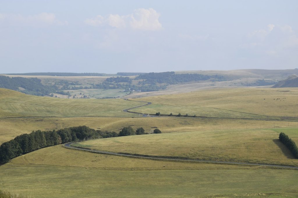
5. Savannah Hills: Sumba’s Golden Sea
Sumba’s interior savannah is as iconic as its waterfalls. From the road, you glimpse hills through windows in the brush. From the air, they become a rolling ocean of ridges.
Key reasons these hills shine from above:
- Seasonal palette: In dry months, the landscape shifts to golds and browns; in the wet, it glows in layered greens.
- Textured ridgelines: Sunlight rakes across scalloped slopes, emphasizing shadows and contours.
- Scattered villages and fields: Thin ribbons of dirt roads link small clusters of houses, revealing how sparsely populated the interior remains.
Many guests describe this segment as the moment Sumba “clicks” in their imagination: a rare sense of vastness so close to the equator.
6. Remote Beaches and Cliffs
While popular beaches like Walakiri or Mandorak are lovely from the sand, helicopters excel at revealing the hundreds of unnamed bays and headlands that rarely see visitors.
From above, coastal Sumba offers:
- Cliff‑backed coves: White sand arcs at the foot of limestone walls, sometimes accessible only by boat or long hikes.
- Reef mosaics: At low tide, reef flats turn into complex patterns of blues, greens and ochres.
- Surf lines: Long, peeling waves trace the edge of the island, especially on exposed west and south coasts.
Pilots can often adjust lines slightly for photography, within fuel and safety constraints, so it helps to mention if coastal aerials are a priority when you plan your trip.
7. Ratenggaro Traditional Village: Megaliths and Headland
Ratenggaro is a famous traditional village in Southwest Sumba, known for its tall peaked roofs and megalithic tombs by the sea.
From the air, Ratenggaro stands out because:
- Headland position: The village sits on a small promontory with a river mouth and beach on one side, open coast on the other.
- Roofscape: The high thatched roofs form spires that cluster around stone tombs, creating a striking geometric pattern.
- Cultural context: You see how the village relates to fields, grazing land and nearby hamlets, not just the ceremonial center.
Respect for local communities is central. Helicopters typically keep sufficient altitude over villages to minimize noise intrusion, passing rather than hovering.
8. Praijing Village: Hilltop Silhouette
Praijing, in the central highlands, is another traditional Sumbanese village that reads differently from the air than from its footpaths.
Aerial features include:
- Hilltop cluster: The village occupies a hill, so from above you see rings of houses and tombs wrapping the summit.
- 360‑degree views: On clear days, surrounding valleys, rivers and road lines radiate out like spokes.
- Morning and afternoon light: The tall roofs cast long shadows; flight timing can dramatically change the atmosphere of the aerial images.
Many itineraries combine Praijing with nearby valleys and savannah ridges, forming a compact inland cultural‑landscape loop.
—
Sample Helicopter Routes Over Sumba
Routes are fully customisable, but most travellers gravitate toward a few proven patterns. All flight durations below are typical air time only and do not include briefing or transfers.
West Sumba Highlights (Approx. 30–45 Minutes in the Air)
Ideal for guests based in the western part of the island who want a first taste of Sumba from above without committing to a very long charter.
Typical inclusions:
- Passes over savannah hills close to the resort belt
- A canyon approach to Lapopu Waterfall or a comparable central‑west waterfall
- River valleys and village clusters
This format prioritises diversity over distance: you experience hills, rivers and at least one major waterfall within a compact loop.
West Coast & Weekuri Lagoon Loop (Approx. 45–60 Minutes)
For guests particularly interested in coastal scenery, reef structure and the famous lagoon.
Typical inclusions:
- Off‑shore track along sections of the west coast for cliff, reef and surf views
- Orbits above Weekuri Lagoon and adjacent reef
- Headland passes near traditional villages such as Ratenggaro (altitude permitting and subject to local conditions)
- Return over inland savannah for contrast
Light changes throughout the day: morning often brings softer contrast and sometimes gentler winds; late afternoon can give dramatic shadows on cliffs.
Central Savannah & Prairie Ridge Tour (Approx. 60 Minutes)
Designed for travellers who are especially drawn to the island’s wide‑open interiors.
Typical inclusions:
- Extended time over rolling savannah ridges and steep valleys
- Selected waterfall overflights such as Lapopu or Tanggedu (depending on base and fuel plan)
- Crossings above river confluences and agricultural pockets
- Optional inclusion of Praijing village and surrounding highlands
This is the route where changing altitudes can be most instructive. Higher segments give broad, map‑like vistas; lower passes (within regulations) bring out texture and detail.
Grand Sumba Circuit (Approx. 90 Minutes+)
For HNW guests who want an in‑depth survey of Sumba by helicopter, operators can often design a near‑island‑wide circuit, departing from the west and reaching into central and southern regions.
Typical inclusions:
- Major waterfalls (Lapopu, Tanggedu area, and/or others depending on operational constraints)
- Key traditional villages such as Ratenggaro and Praijing
- Weekuri Lagoon and selected coastal headlands
- Large sections of interior savannah and river systems
This kind of flight requires careful planning around fuel, weight and weather windows. It’s best arranged well ahead of travel via WhatsApp or email so pilots can advise on feasibility and spacing.
—
Helicopter Charter Pricing on Sumba (Honest Range Guidance)
Helicopter charter prices in Indonesia are driven by several factors:
- Aircraft type and age
- Base location and re‑positioning needs
- Duration of the charter (air time, not clock time)
- Fuel and maintenance costs, which can fluctuate
On Sumba, most sightseeing experiences use light to medium helicopters on a private basis. Based on Indonesia‑wide market data we monitor (not Sumba‑published tariff sheets), the following estimate ranges apply.
All figures below are estimate ranges in USD, last verified June 2026. The exact quote will always come directly from the operator before you confirm.
| Type of Experience | Typical Air Time | Private Charter Estimate (USD)* | Notes |
|---|---|---|---|
| Short scenic flight (local highlights) | 20–30 minutes | Approx. 1,200–2,000 | Usually focuses on nearby savannah and 1–2 key sights. |
| Signature highlights loop | 30–45 minutes | Approx. 1,800–3,000 | Often combines savannah, a main waterfall, and coastal segment. |
| Extended coastal + waterfall loop | 45–60 minutes | Approx. 2,400–4,000 | Allows Weekuri plus inland waterfall and villages. |
| Grand circuit or multi‑stop day use | 60–90+ minutes | Approx. 3,500–6,500+ | Pricing depends heavily on routing, stand‑by time and fuel. |
*Estimate ranges only, last verified June 2026. Your final price is always confirmed directly by the chosen operator before any commitment.
Expect pricing to be quoted per helicopter, not per seat. Splitting the charter cost among your party can make even longer routes relatively good value for the time saved.
If you’d like us to translate a wish‑list of Sumba by helicopter sights into realistic route options and quotes, you can plan your trip with our team; we coordinate via email and WhatsApp and then introduce you to a vetted operator. No one can pay to change what we publish; if you proceed with our partner they may pay us a referral fee at no extra cost to you.
—
Practicalities: Weather, Seasons and Safety
Weather and Seasonality
Sumba’s climate has a marked dry and wet pattern, which shapes flight reliability and what you’ll see.
- Dry season (roughly May–October): Skies are often clearer, with drier air and stronger light. Savannah turns golden, and waterfalls may run lower but are still visually striking.
- Transition months (around April and November): Can offer lush landscapes with more cloud build‑up and occasional showers. Photography can benefit from softer light and dramatic clouds.
- Wet season (roughly December–March): Expect higher humidity and more frequent rain. Waterfalls swell, rivers run stronger, but there is also a higher chance of flight delays or cancellations for safety.
Helicopter operations are always weather‑dependent. Operators will not fly in unsafe conditions, and flights cannot be guaranteed on a particular day or time. Flexible itineraries, especially in the wet season, give you the best chance to fly.
Time of Day for Sumba from Above
Broadly:
- Morning: Often smoother air, with softer light and reduced haze. Good for waterfalls and villages.
- Midday: Strong overhead light can flatten some scenes but emphasises water color in lagoons and reefs.
- Late afternoon: Lower sun angles give deeper shadows on hills and cliffs; can be spectacular for photography if conditions are stable.
Exact slots depend on aircraft availability, crew duty regulations and local weather systems on the day.
Safety and Regulation
All operators we work with must hold appropriate Indonesian aviation approvals and operate within national safety standards. As an independent service, we:
- Vet operators for licensing, maintenance culture and experience
- Request recent documentation and updates as part of ongoing checks
- Encourage clear briefings about routes, altitudes and contingency plans
On board, standard practices include wearing headsets, following weight and balance limits, and keeping loose items secured. If you have mobility issues or specific medical considerations, mention them at enquiry stage so the operator can assess suitability.
—
Designing Your Own Aerial Sumba Day
Every group has different priorities: some are photography‑driven, others want a fast survey before committing to ground explorations. Here are ways to think about tailoring your flight.
- Primary focus: Waterfalls
- Ask for routes that prioritise Lapopu and Tanggedu area canyons, even if that means less coastal time. Water volume and clarity vary by season.
- Primary focus: Traditional villages
- Combine passes over Ratenggaro and Praijing with moderate altitude to respect communities while still capturing context.
- Primary focus: Coast and lagoons
- Emphasise Weekuri Lagoon, reef shelves, headlands and remote beaches. A modest inland segment keeps variety.
- Photography priorities
- Request slower orbits where feasible, windows with minimal tint, and seat assignments suited to your dominant shooting side (left/right).
- Time vs. budget
- If budget is tight, a 20–30 minute local flight over savannah and one hero feature often offers the best value. If time is scarce, longer sorties consolidate days of driving into one morning.
Our role is to translate your wish‑list into feasible flight plans within local constraints. If you share your dates, group size, resort base and key preferences, we can suggest route options before introducing you to a specific operator: start the process via plan your trip and we’ll continue on WhatsApp for fine‑tuning if you wish.
—
Preparing for Your Flight Over Sumba
What to Wear and Bring
- Clothing: Light, comfortable layers. Avoid loose scarves or hats that can blow around rotor zones.
- Footwear: Closed shoes or secure sandals; heels are not practical around aircraft.
- Sun protection: Sunscreen and sunglasses; light glare can be strong above water and bright savannah.
- Cameras: DSLRs/mirrorless or high‑end phones are all workable. Lenses in the 24–70 mm range are versatile for most aerial shots.
Ask the operator in advance if windows open or are fixed, so you can plan for reflections. A dark shirt often helps minimise self‑reflections in glass.
Managing Expectations
- Routes are indicative, not rigid: Pilots may need to adjust tracks on the day for weather, airspace or safety.
- No wildlife guarantees: Horse herds, sea life or birds may appear, but sightings cannot be promised.
- Village overflights and sensitivity: Respecting local communities means avoiding low, noisy circling over settlements.
Good aerial Sumba experiences balance ambition with realism; the pilots know the terrain and the day’s conditions best.
—
Is Sumba from Above Right for You?
Seeing Sumba from above is especially rewarding if you:
- Value time efficiency and want to compress a large, sparsely roaded island into a single coherent visual narrative
- Care about landscape photography or simply enjoy seeing the “shape” of a place
- Prefer private, low‑friction experiences where you control timing within operational limits
It might be less suitable if you dislike small aircraft, prefer slow, ground‑level immersion only, or have very fixed schedules during peak wet months, where weather disruption tolerance is low.
If you’re unsure, we can outline one or two realistic route ideas with pricing and operational notes for your specific dates, so you can decide calmly. Share your plans via plan your trip and we’ll follow up—typically moving to WhatsApp for faster, on‑the‑ground style planning once we understand your priorities.
—
How far in advance should I book a helicopter flight on Sumba?
For peak dry season and holiday periods, aim to start planning at least 4–8 weeks ahead, especially for longer or more complex routes. Shorter scenic flights outside peak dates can sometimes be organised closer in, but aircraft and crew availability are never guaranteed, so more notice usually means more options.
Can we land at waterfalls or villages during our flight?
In many cases, sightseeing flights are flown as overpasses only, with no landings at waterfalls or inside villages, due to terrain, safety and permission constraints. Some itineraries may allow landings at designated helipads near lodges or approved sites, but this depends on operator approvals and day‑of conditions; any possible landings will be discussed explicitly in your route proposal.
How many people can fly together?
Typical helicopters used for private charters in Indonesia carry between 3 and 6 passengers, depending on model and weight limits. The exact capacity for your group will be clarified by the operator based on aircraft type, total passenger weight, luggage (if any) and fuel requirements for the chosen route.
What happens if weather prevents us from flying?
If conditions are unsafe or below the operator’s minimums, flights may be delayed, re‑routed or cancelled. Policies on rescheduling and refunds vary by operator and will be outlined in your booking terms. We always encourage keeping at least one “backup” window in your itinerary, especially in wetter months, to improve your chances of flying.
How do payments and our independence work?
After we help you refine routes and select a suitable operator, payments are made directly to that operator or their appointed agent, under their terms. We are independent: no one can pay to change what we publish; if you proceed with our partner they may pay us a referral fee at no extra cost to you.